")
")

Bugatyn khuree
Read in Mongolian
Name(s) of Temple :
Bugatyn khuree,
Rinchen Number :
83
Rinchen Name :
Bugyn khuree, Bugyn khural
Type of Monastery/Temple:
Temporary Assembly
Aimag where the temple is located:
Zavkhan
Sum where the temple is located:
Yaruu sum
Old Aimag Name :
Tusheet Khan
Old Khoshuu Name :
Sartuuliin neg khoshuu
Historical Summary (In Mongolian only):
Завхан аймаг Яруу сум. Бугатын хурал /жасаа хурал/ Хуучин Засагт хан аймгийн Цэцэн сартуулын хошууны нутаг одоогийн Яруу сумын Бугат багийн Бугын голын адагт энэ хурал төвхнөж байжээ.Бугатын жасаа хурал нь 1880-аад оны дундуур байгуулагдсан бөгөөд 1 жижиг дуган сахиусын 1 жижиг сүмтэй байсан байна.Уг хурал нь Яруугийн хүрээнээс салбарласан жасаа хурал бөгөөд сар жилийн дүйцэн өдрүүдэд Яруугийн хүрээнээс лам нар гарч ирж хурал хурдаг байжээ.Хурал хураагүй бусад цагт тахилч лам мөнх зултай байж бухан тахил зул хүжийг нь өргөж байв.Зуны эхэн сарын шинийн 8-нд энд цугласан лам нар дуганы ойр байх Хүүхдийн овоог тахидаг байжээ.Дуганы гол сахиус нь Найдан жүд бурхан байсан бөгөөд лам нархошуу нутгийн мал сүргийг өсгөх хүн ардын сайн сайхны төлөө Банзрагч номыг хурдаг байсан тухай мэдээлэл байна.Тус хурал нь 1937 оны үед Яруугийн хүрээг татан буугдахын өмнө хаагдсан бөгөөд одоо хурлын дуганын туурь газрын хөрсөнд мэдэгдэхгүй шахам болжээ. /Дашчойпэл хийдийн лам Н.Жамцтай хийсэн ярилцлагаас 2007.06.26/
Description of location :
The site is located near the river Bugyn gol in the area of the Bugat team of Yaruu sum in Zavkhan province. Along the back of the site lies the sandy Elst Undur mountain. The site is surrounded by Bugatyn gol and BUgatyn mountain pass. Herders live in the valley over the summer and autumn months. The banks of Bugatyn river, especially the north side, are sandy. The ground on south side of the river is hard. Sacred KHuukhdiin ovoo is to the west of the river. There are no towns nearby.
GPS coordinates :
North 48° 20’ East 096° 33’
Total site area:
Side1: 80 Side2: 50 Side3: Side4: Side5: Side6:
Revived temple on site :
No
Site status at the time of survey :
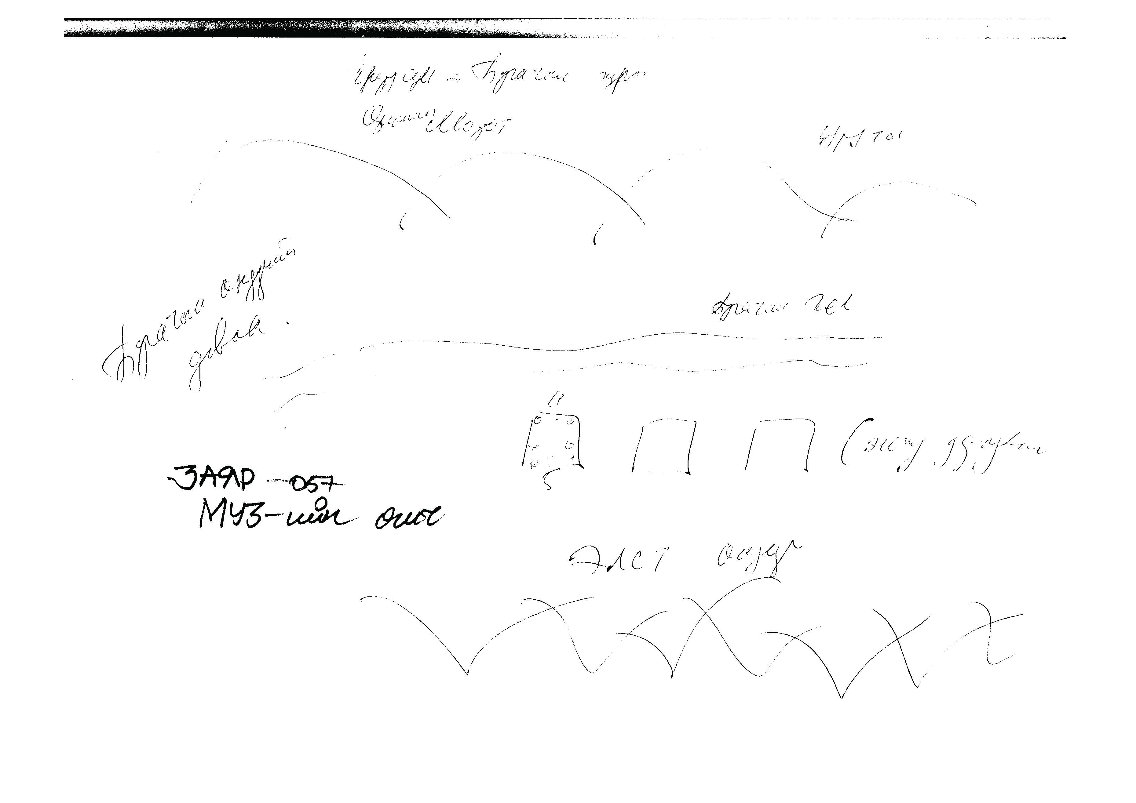
The foundations of one temple and three other buildings are barely visible on the site. Nowadays the site is covered with sand, thus no other distinct signs are visible. It is very hard to cross the river. The eastern most foundation is, according to the locals, the main temple and it measures 4M x 5M. Clearly this was not a big monastery. The size of the site and the locals accounts both seem to prove it.
Date of establishment of the monastery/temple :
Unknown
Date of closing and destroying the monastery :
Revival of the old monastery/temple:
No
Founder's name and title (if known):
Name and title : Unknown - Interview Number: 001
Date of Revival:
Monks in Old Temple :
not clear
not clear
Form Number :
ЗАЯР 057
Survey Team :
Team А