Khureenii tuv
Read in Mongolian
Name(s) of Temple :
Khureenii tuv,
Rinchen Number :
77
Rinchen Name :
Golyn khuree
Type of Monastery/Temple:
Monastic School
Aimag where the temple is located:
Zavkhan
Sum where the temple is located:
Otgon sum
Old Aimag Name :
Zasagt Khan
Old Khoshuu Name :
Khoshuuch beiliin khoshuu
Historical Summary (In Mongolian only):
Завхан аймаг Отгон сум. Голын хүрээ Сайн ноён хан аймгийн Хошууч бэйсийн хошууны нутаг одоогийн Отгон сумын Буянт багийн төвд Голын хүрээ хэмээх энэ хурлын газар оршиж байжээ.1880аад оны үед 10 гаруй ламтай 2 дуган, 1 сүмтэй байгуулагдаж байсан энэ хурлын газар нь 1930-аад оны үеийг хүртэл 20 шахам лам сууж байнга хурдаг хурлын газар байжээ.Харин 1930-аад оны үеэс тодорхой бус шалтгааны улмаас лам нарын то цөөрч зөвхөн сар жилийн дүйцэн өдрүүдэд 6-10 лам цуглаж хурдаг бусад үед зөвхөн тахилч лам мөнх зултай хурал байв.1937 онд уг хурал бүр мөсөн хаагдсан бөгөөд үлдэж хоцорсон 2 дуган 1950-иад оны дунд үеийг хүртэл байж байсан байна.1950 оноос энд Отгон сумын Буянт багийн төв төвлөрөн байрлах болсон тул дуганыг амбар сав болгон ашиглаж бйаснаа хожим нь нураажээ.Одоо дуганын туур мэдэгдэхгүй бөгөөд багийн твийн барилга айлуудын хашаа хороотой нийлжээ.Харин 1990-ээд оны үед 1 дуган байсан туури дээр нь энэ нутгийн уугуул иргэн Батмэндийн Дугаа гэдэг үхн өөрийн хүч хөрөнгөөр 4м:5м жижиг хэмжээний модон сүм барьжээ.Энэ сүм нь одоогоор дотроо бурхан тахилын зүйл байхгүй бөгөөд үүсгэн байгуулагч нь хааяа ирж зул хүж өргөдөг.Мөн жил бүрийн зуны эхэн сард хөрш сумуудаас лам нар авч ирж уншлага хийлгэдэг ажээ.Голын хүрээ хэмээх хурлын газар нь Буянт голын эрэгт байсан учир Голын хүрээ хэмээн нэрлэгдэж байсан ба лам нарын тоо сүм, дуганын тоо хурал номын цар хэмжээгээрээ хүрээ биш жижиг хийд байсан бололтой. /Буянт багийн өндөр настан Цэгмид гуайтай хийсэн ярилцлагаас 2007.06.29/
Description of location :
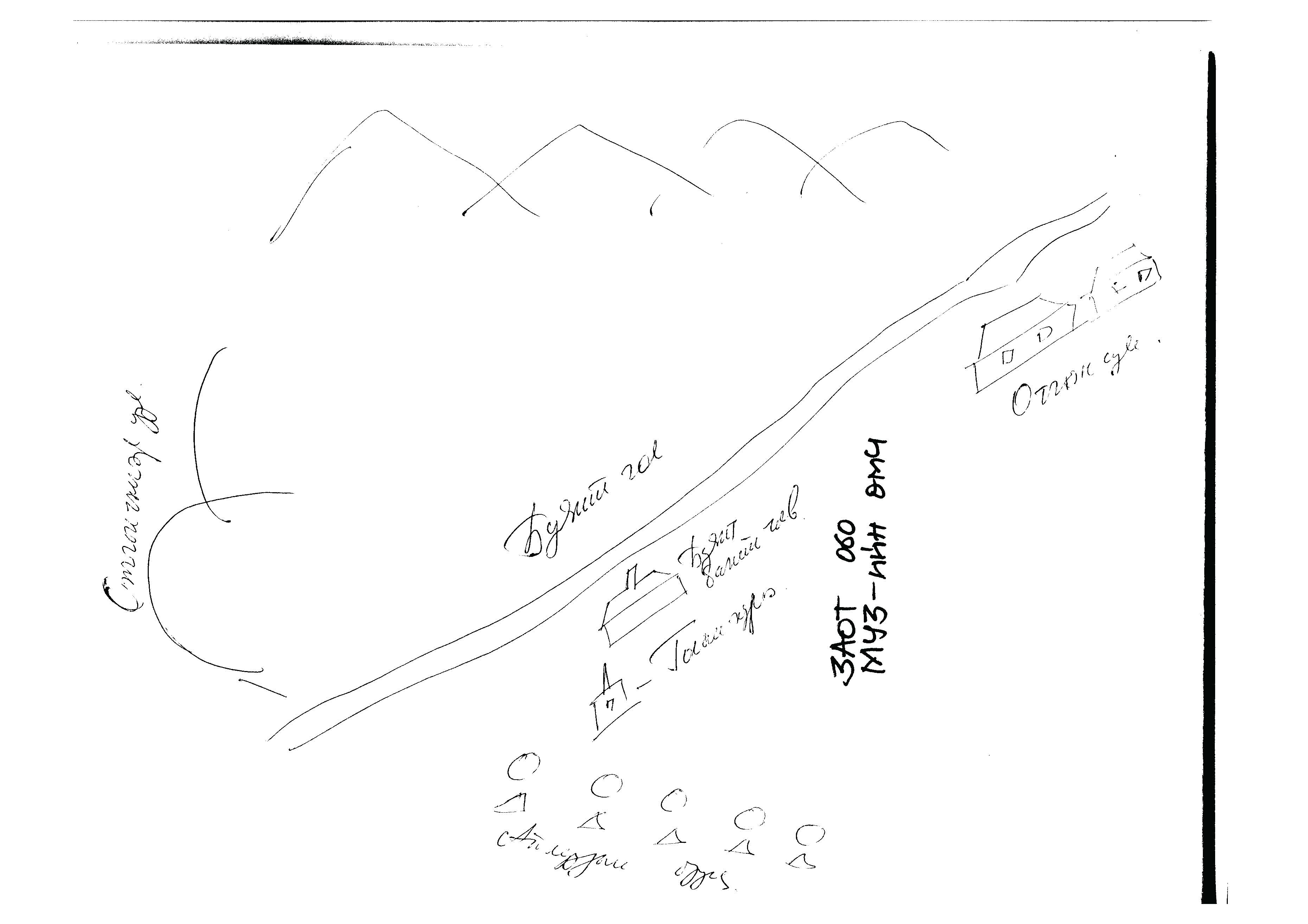
The site is located on the south side of the Khangai mountain range, where it crosses with Gobi-Altai mountain range in the national park of Otgontenger mountain. The site is 25Km from Otgontenger mountain. Buyant river runs down the south slope of the Otgontenger mountain. This mountain has been worshiped from ancient times and it was also a sacred mountain worshiped by the state. Since 1950 Buyant team’s centre of Otgon sum has been located here. Families move towards the river Buyant during the summer.
GPS coordinates :
North 47° 27’ East 097° 45’
Total site area:
Side1: 6 Side2: 7 Side3: Side4: Side5: Side6:
Revived temple on site :
No
Site status at the time of survey :
The historical site is not recognizable as the team centre buildings and cattle shelters are built on the site. In 1990 a new wooden temple measuring 4M x 5M was built on the site. During the construction of the temple some religious items and statues were found. The local elder Dugai Batmendiin, the sum’s “elephant” (wrestling title), was the moving force behind building the new temple. Dugai lights candles inside the temple once in a while. One June some monks were invited to recite sutras in the temple. There are no statues inside. The watchman did not allow in the temple to take photographs.
Date of establishment of the monastery/temple :
Unknown
Date of closing and destroying the monastery :
Revival of the old monastery/temple:
No
Founder's name and title (if known):
Date of Revival:
Monks in Old Temple :
not clear
not clear
Form Number :
ЗАОТ 060
Survey Team :
Team А